the Picardy Coast & the Bay of the Somme
The Picardy Coast, which stretches from the mouth of the Bresle in the south to the Authie Bay in the north, is a beautiful lesson in living geography.
This coastline unfolds over its 60 kilometres of coastline a varied and exceptional landscape.
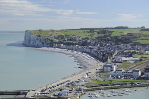
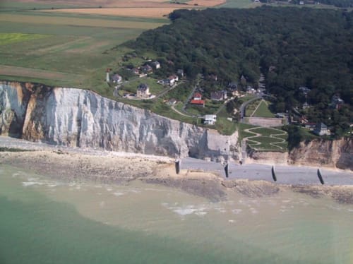
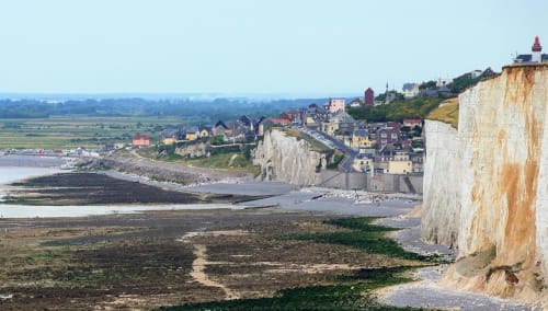
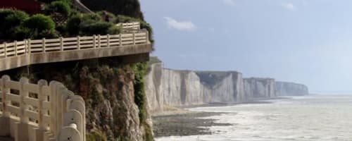
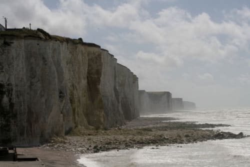
From Mers-les-Bains to Ault-Onival, the cliffs, which rise to more than 60 metres, face the waves that tear away their powerful flints.
The resort of Ault-Onival, situated on a "balcony over the sea", offers superb views of the surrounding coastal landscapes. Further on, the sharp cliffs give way to the dead cliffs, forever separated from the sea by a pebble dike at the foot of which lie the low fields with the Hâble d'Ault water bodies.
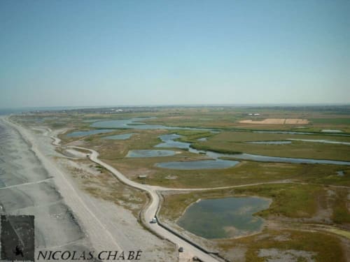
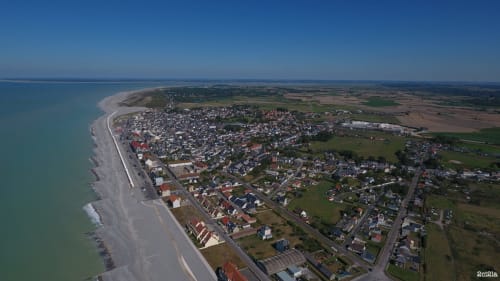
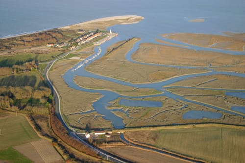
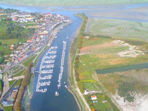
Framed by the Hourdel point to the south and the Saint-Quentin point to the north, the vast bay of the Somme covers 70 km2 and is a unique place where the channels, sandbanks and mollières where the sheep of the salt meadows and the Hensons horses graze are intertwined.
This coastline unfolds over its 60 kilometres of coastline a varied and exceptional landscape.
From Mers-les-Bains to Ault-Onival, the cliffs, which rise to more than 60 metres, face the waves that tear away their powerful flints.
The resort of Ault-Onival, situated on a "balcony over the sea", offers superb views of the surrounding coastal landscapes. Further on, the sharp cliffs give way to the dead cliffs, forever separated from the sea by a pebble dike at the foot of which lie the low fields with the Hâble d'Ault water bodies.
Framed by the Hourdel point to the south and the Saint-Quentin point to the north, the vast bay of the Somme covers 70 km2 and is a unique place where the channels, sandbanks and mollières where the sheep of the salt meadows and the Hensons horses graze are intertwined.
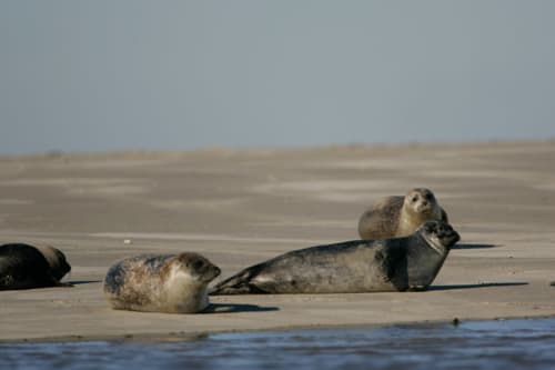
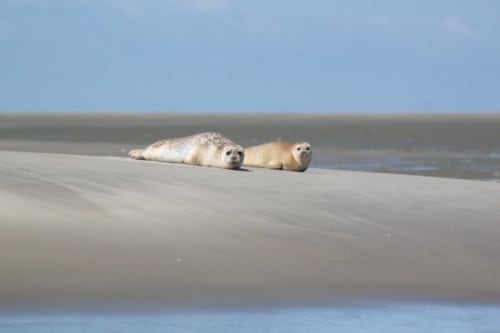
The ideal place to observe seals in the Baie de Somme
At the Hourdel point you can observe seals, we advise you to take a guide for a better discovery.You can also discover the little train of the Bay of the Somme which goes from Cayeux-sur-Mer to Le Crotoy. To the north, the Marquenterre beach, with its 20 kilometres of fine sand, and its magnificent park and bird observatory, which borders one of the largest dune massifs in northern Europe, in which there are discovery routes.
Seaside resorts to experience
From South to North ...
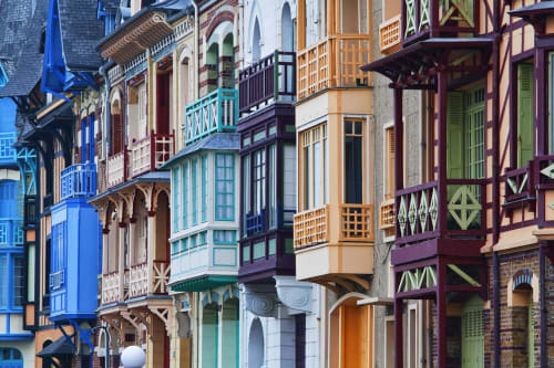
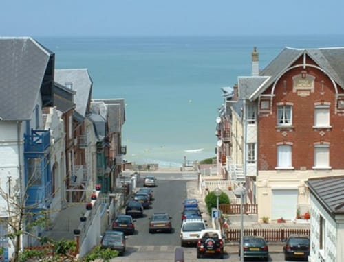
With its listed seaside district and its Belle Époque villas with balconies and multicoloured facades, Mers-les-Bains developed at the end of the 19th century, thanks to the discovery of sea bathing and its therapeutic benefits. The "bathers" settled there and built villas in the Anglo-Norman, Flemish, Picardy, Moorish, Renaissance, Louis XIII, Napoleon III and 1930s styles, making Mers-les-Bains a unique architectural gem.
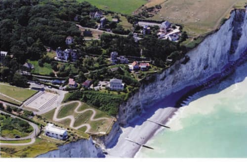
LE BOIS DE CISE
Au sud de Ault se situe le bois de Cise qui est un bois littoral plein de charme et qui fut à l’origine un bois sauvage puis un lieu de chasse à courre au Moyen Âge. Fin 19ème, à l’initiative d’un promoteur immobilier, le bois de Cise fut vendu par lot et devint une station balnéaire qui connut son heure de gloire pendant la Belle Époque. Aujourd’hui, c’est un lieu de villégiature et de promenade plein de charme où il est conseillé de se déplacer à pied au gré des nombreux petits chemins et escaliers en bois qui parcourent le site ...
Au sud de Ault se situe le bois de Cise qui est un bois littoral plein de charme et qui fut à l’origine un bois sauvage puis un lieu de chasse à courre au Moyen Âge. Fin 19ème, à l’initiative d’un promoteur immobilier, le bois de Cise fut vendu par lot et devint une station balnéaire qui connut son heure de gloire pendant la Belle Époque. Aujourd’hui, c’est un lieu de villégiature et de promenade plein de charme où il est conseillé de se déplacer à pied au gré des nombreux petits chemins et escaliers en bois qui parcourent le site ...
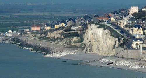
AULT
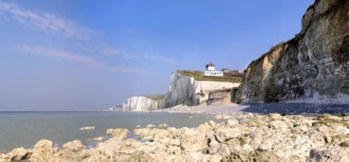
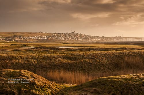
Ault is a coastal transition point where the chalk cliffs of the Côte d'Albâtre begin. Superb panorama on the cliffs to admire from the beach of Onival.
The 250 hectares of Hâble are a real paradise for swans, coots, gravelots, teal, herons and harriers.
Ault is a coastal transition point where the chalk cliffs of the Côte d'Albâtre begin. Superb panorama on the cliffs to admire from the beach of Onival.
The 250 hectares of Hâble are a real paradise for swans, coots, gravelots, teal, herons and harriers.
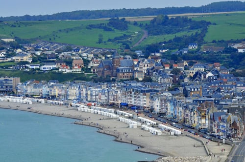
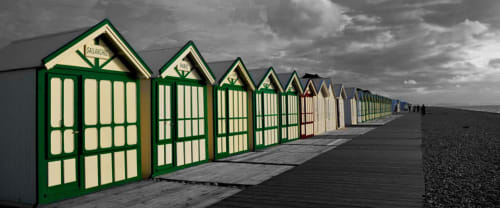
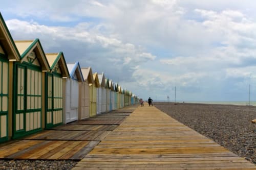
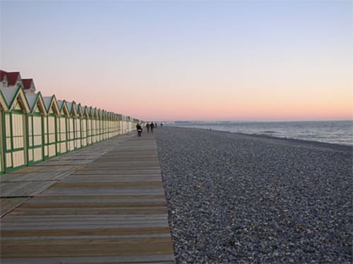
CAYEUX-SUR-MER
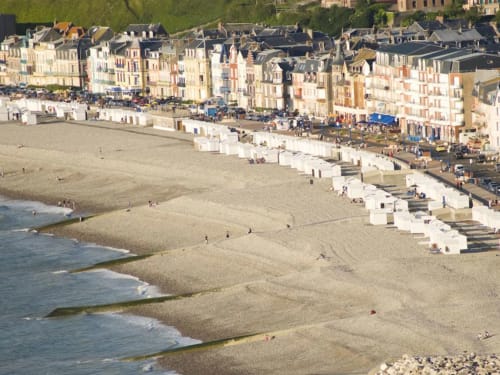
The origin of the name Cayeux-sur-Mer comes from Cayeu or Cailleux, which means pebble. Its history is linked to that of the "galet", the real mineral wealth of the region. Its plank path of more than 2 kilometres is the longest in Europe and allows you to walk along the beach as in the last century without ever stepping on the pebbles.
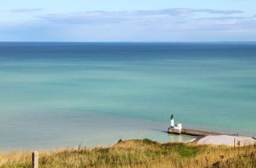
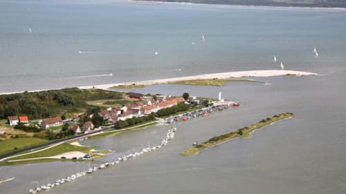
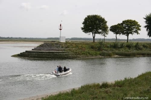
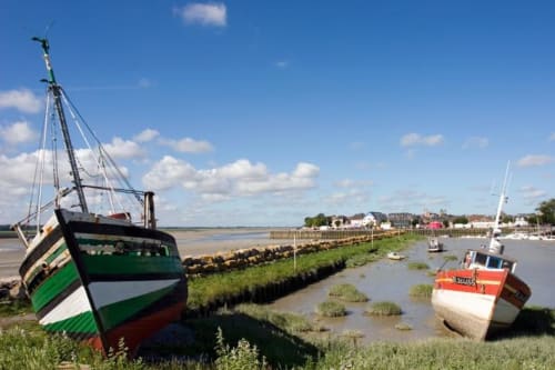
THE HOURDEL POINT
Le Hourdel is a hamlet in the commune of Cayeux. It is a small fishing port, nowadays somewhat abandoned because of the silting up of the Bay of the Somme.
Le Hourdel is a well-known place for observing the seals of the Baie de Somme. It is home to the largest colony of marine calves in France.
The best way to observe the seals is to take the "Petit Charcot".

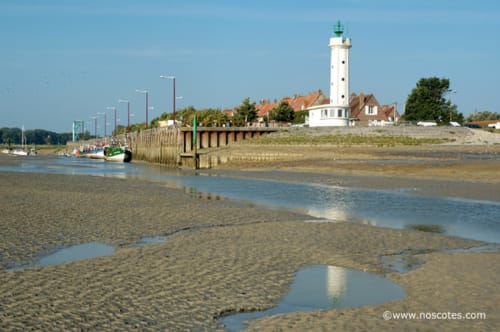
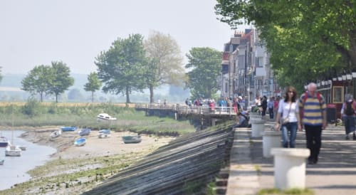
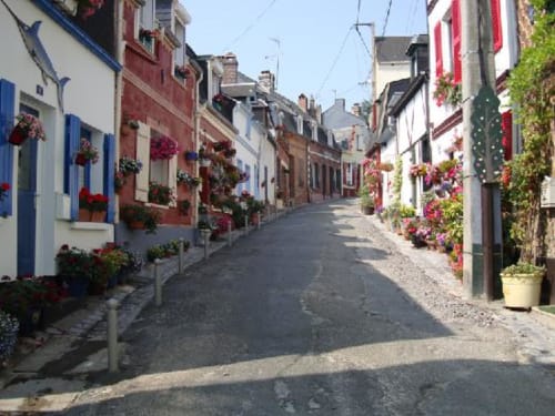
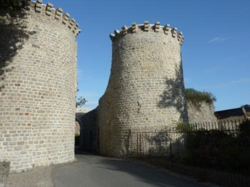
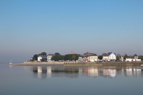
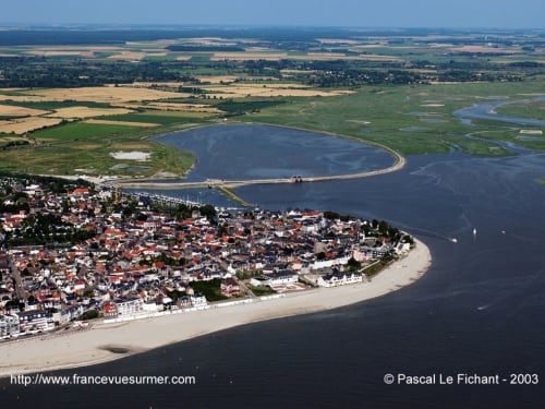
SAINT-VALÉRY-SUR-SOMME
"Saint-Valery is a small port town on the Bay of the Somme, made up of three entities: the lower town (La Ferté) where the port is located, the abbey quarter as an extension of the old town (upper town) and its medieval charm with its narrow streets, its two fortified gates, the ramparts and the church of Saint-Martin. The sailors' quarter of Saint-Valery is called the "Courtgain" and is made up of narrow houses that slope down to the port.
A little tip: don't miss the Sunday morning market along the quays!

LE CROTOY
Le Crotoy is situated on the northern shore, at the bottom of the Bay of the Somme, on the English Channel. The commune is part of the natural region of Marquenterre.Le Crotoy has the characteristic of having a fine sandy beach facing south (hence the name "plage blanche"). Indeed, Le Crotoy is on a heath of land on the edge of the Channel, jutting out into the sea. The name of the town would mean "inhabitants of the sands".
Le Crotoy is situated on the northern shore, at the bottom of the Bay of the Somme, on the English Channel. The commune is part of the natural region of Marquenterre.Le Crotoy has the characteristic of having a fine sandy beach facing south (hence the name "plage blanche"). Indeed, Le Crotoy is on a heath of land on the edge of the Channel, jutting out into the sea. The name of the town would mean "inhabitants of the sands".

Other places to visit: Fort-Mahon-Plage, Quend-Plage-les-Pins, (beautiful stretches of beach and sand) Belle Dune, not forgetting Le Tréport on the border with Normandy which is only 18 kilometres from the Château.
In the hinterland, you can also visit the Authie Valley, the Valloire Abbey and its magnificent flower gardens, the Rambures Fortress, the Chapel of the Holy Spirit in Rue, the Collegiate Church of Saint-Vulfran in Abbeville and the Abbey Church of Saint-Riquier, the Château d'Eu and many other places close to the Baie de Somme.
An exceptional natural environment:
The Picardy Coast, recognised as the least urbanised coastline in France, constitutes with its hinterland an exceptional environment due to the richness of its preserved natural environments.
These areas are particularly well suited to hiking, and many birds have chosen this region as their home or resting place during their migratory journey. More than two thirds of the birds found in Europe have been observed here.
For a privileged encounter, the Marquenterre ornithological park, in the Baie de Somme nature reserve, allows you to observe birds in complete freedom
On the other side of the bay, the Maison de l'Oiseau (Bird House) invites you to get to know and understand the life of this winged species through superb reconstructed scenes.